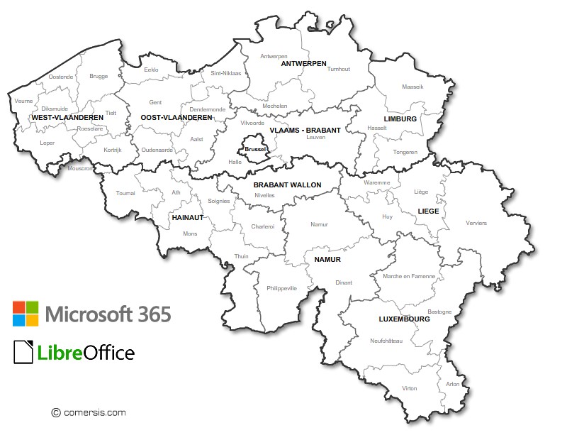
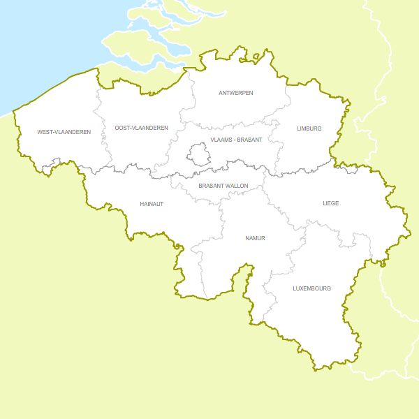
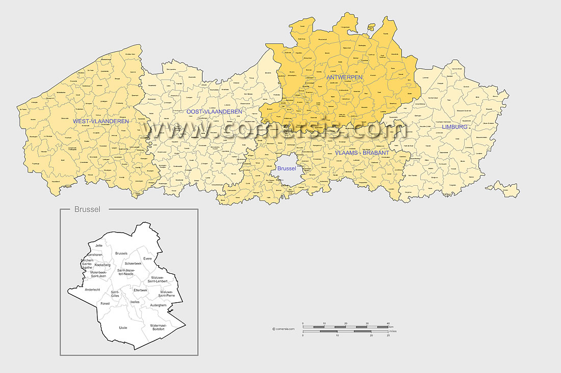
Customizable map of the provinces and districts of Belgium for PowerPoint or Libreoffice.
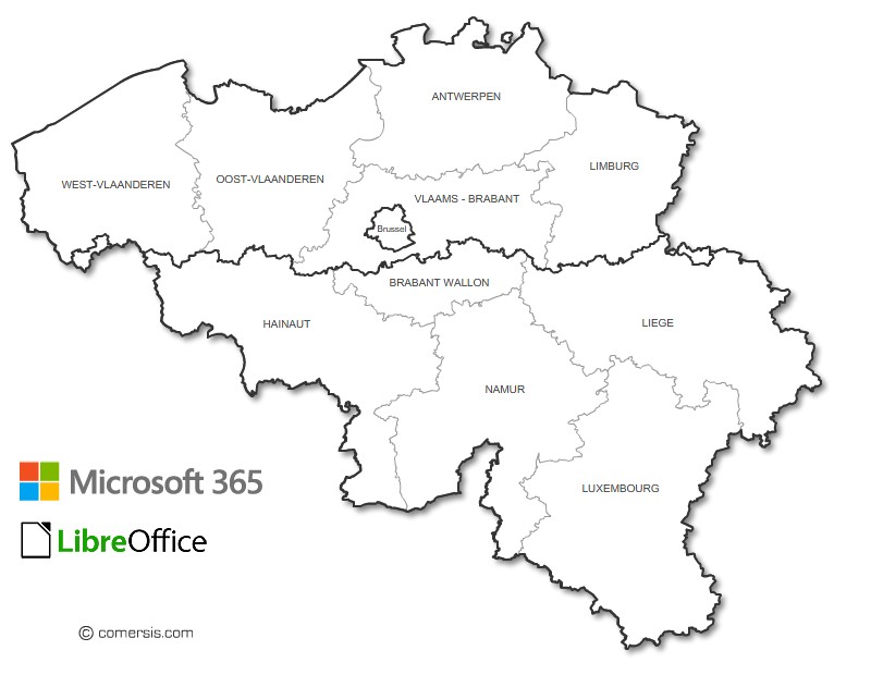
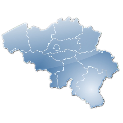
Colorable and customizable map of Belgian provinces for PowerPoint and LibreOffice.

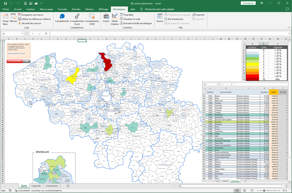
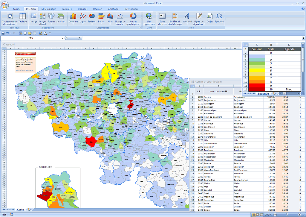
Excel map of the municipalities of Belgium with automatic coloring according to your data (figures, sectors, value brackets, etc.)

Editable free map of West Vlaanderen province
Photoshop layers, Jpeg and Wmf image maps.
Updated june 2017.
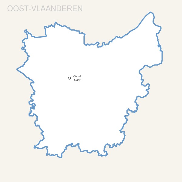
Editable free map of Oost Vlaanderen province
Photoshop layers, Jpeg and Wmf image maps.
Updated june 2017.
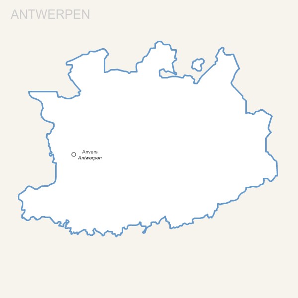
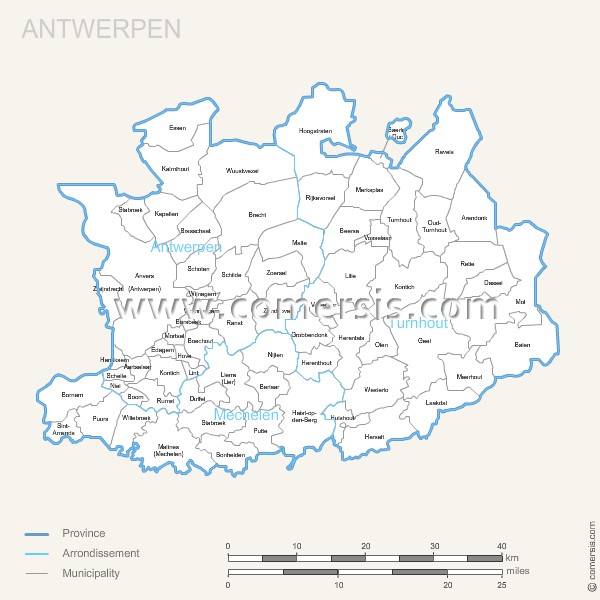
Editable free map of Antwerpen province
Photoshop layers, Jpeg and Wmf image maps.
Updated june 2017.
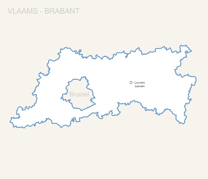
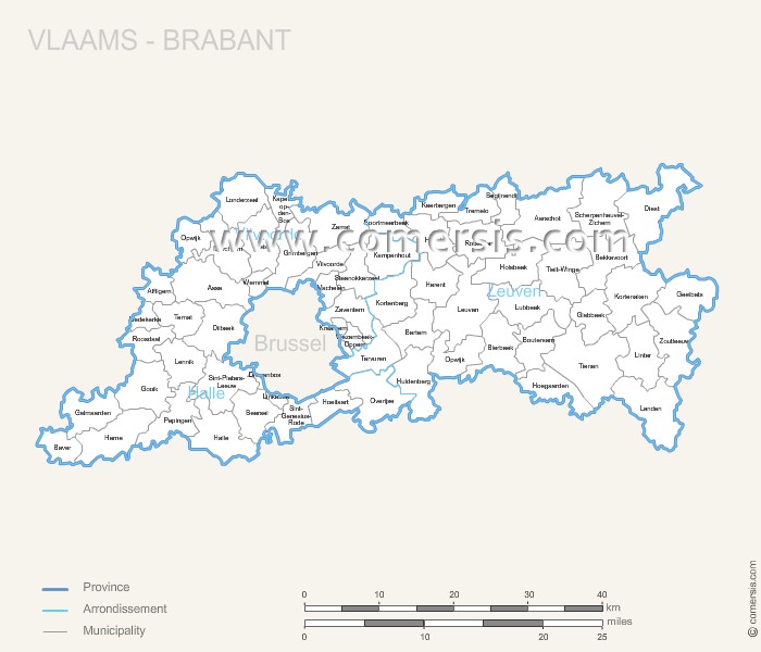
Editable free map of Vlaams-Brabant province
Photoshop layers, Jpeg and Wmf image maps.
Updated june 2017.

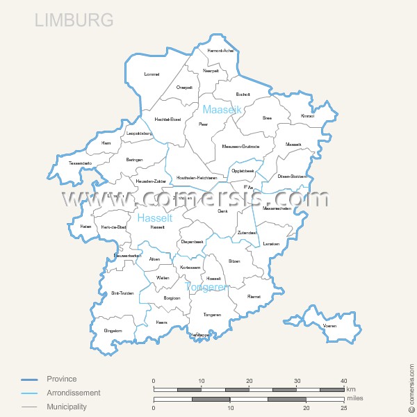
Editable free map of Limburg province
Photoshop layers, Jpeg and Wmf image maps.
Updated june 2017.

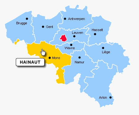
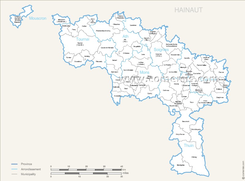
Editable free map of Henegouwen province
Photoshop layers, Jpeg and Wmf image maps.
Updated june 2017.
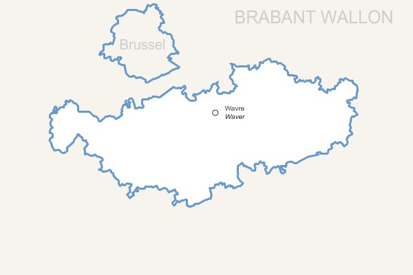
Editable free map of Waals-Brabant province
Photoshop layers, Jpeg and Wmf image maps.
Updated june 2017.
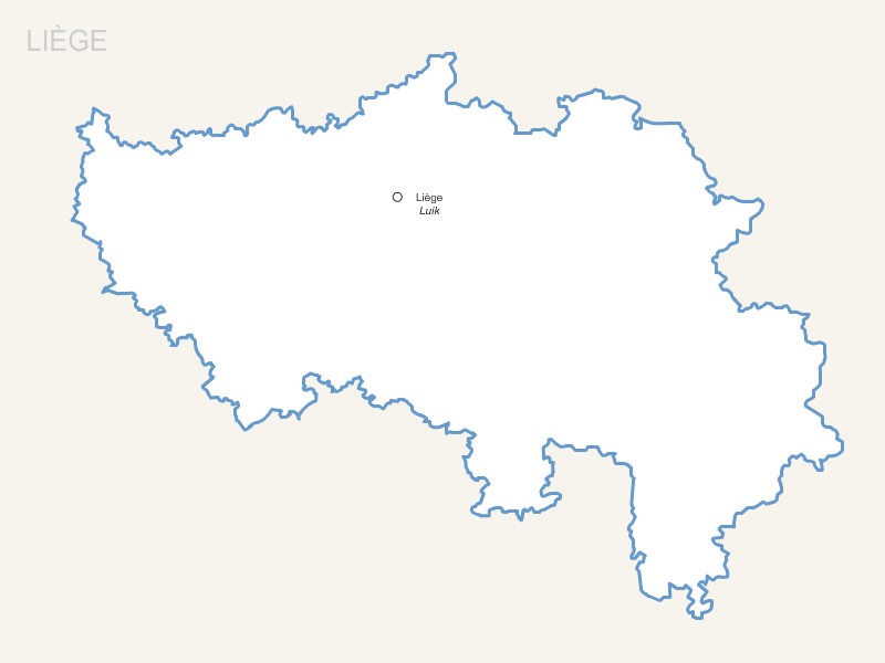
Editable free map of Luik province
Photoshop layers, Jpeg and Wmf image maps.
Updated june 2017.
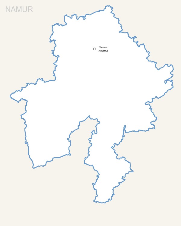
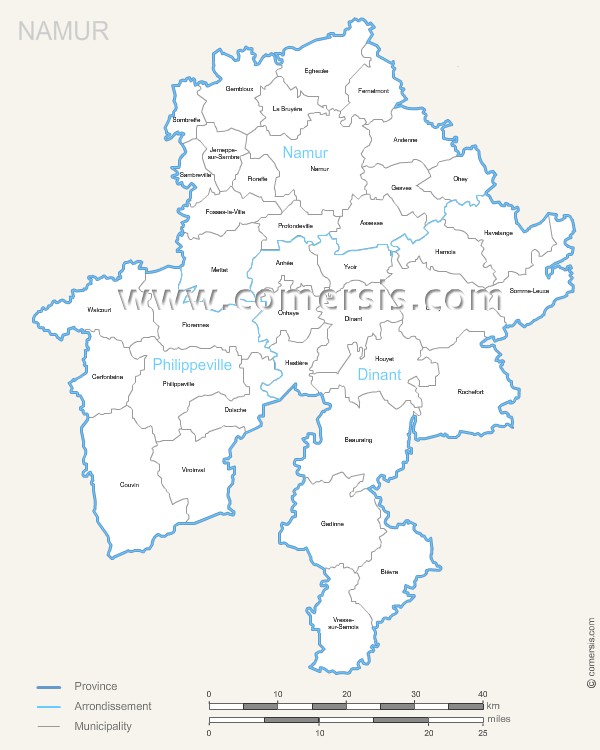
Editable free map of Namen province
Photoshop layers, Jpeg and Wmf image maps.
Updated june 2017.

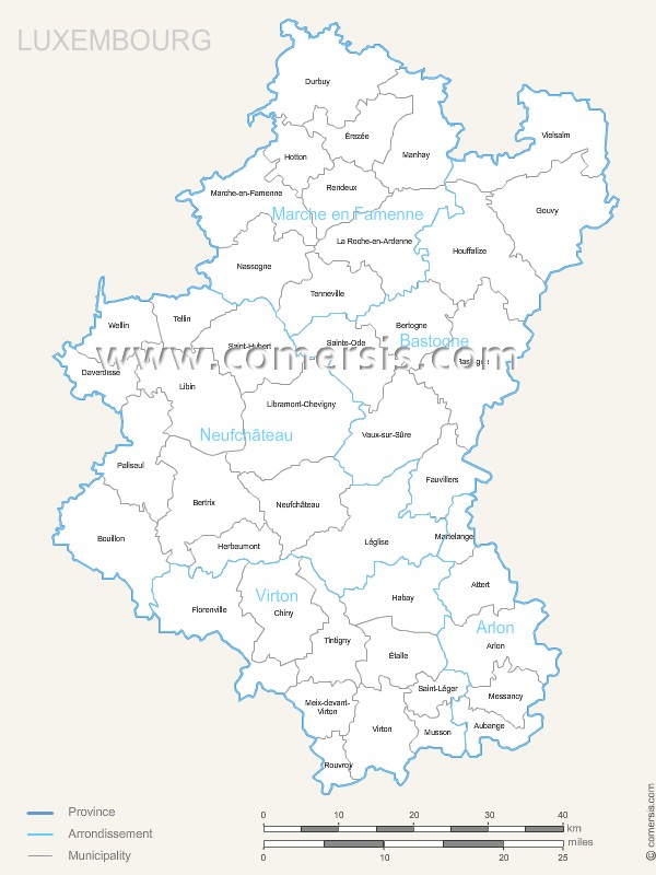
Editable free map of Luxemburg province
Photoshop layers, Jpeg and Wmf image maps.
Updated june 2017.
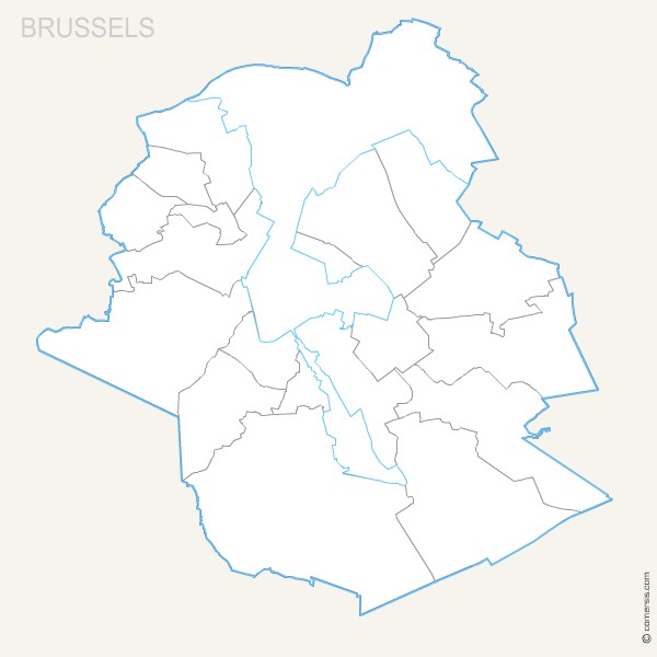
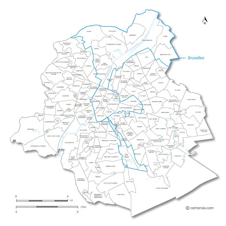
Editable free map of Brussel province
Photoshop layers, Jpeg and Wmf image maps.
Updated june 2017.
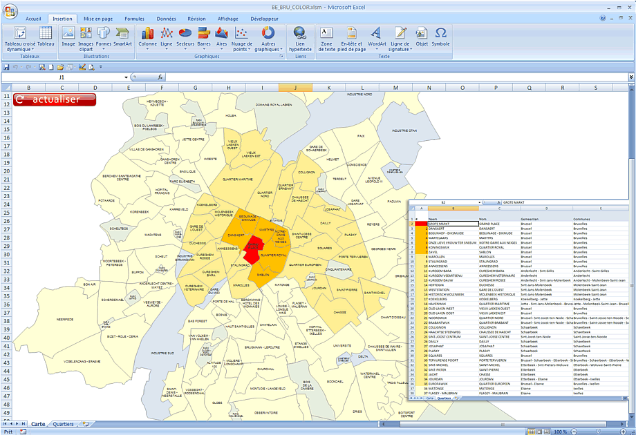
Automatic coloring Excel map of Brussels areas. Enter your values, select your colors and press Refresh button.

Editable map of Brussel municipalities with full name
Each municipality is an independant and editable vector objet (color fill and stroke, size, shape, text...)
Illustrator, Eps, Pdf and Wmf vector maps.
Supplied with the complete list of Brussel cities (Excel file).
Updated june 2017.

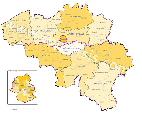
Contour map of the municipalities of Belgium in Illustrator and Eps. Original Size 2000 x 1700 pixels.
Clickable provinces map of belgium.
Colors, buttons, texts and borders editable.
Ready to use map.
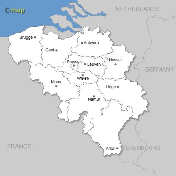
Belgian regions, provinces and districts with names in vector format Illustrator AI, EPS and SVG.

Editable map of Oost Vlaanderen municipalities with full name
Each municipality is an independant and editable vector objet (color fill and stroke, size, shape, text...)
Illustrator, Eps, Pdf and Wmf vector maps.
Supplied with the complete list of Oost Vlaanderen cities (Excel file).
Updated june 2017.
Editable map of Antwerpen municipalities with full name
Each municipality is an independant and editable vector objet (color fill and stroke, size, shape, text...)
Illustrator, Eps, Pdf and Wmf vector maps.
Supplied with the complete list of Antwerpen cities (Excel file).
Updated june 2017.
Editable map of Vlaams-Brabant municipalities with full name
Each municipality is an independant and editable vector objet (color fill and stroke, size, shape, text...)
Illustrator, Eps, Pdf and Wmf vector maps.
Supplied with the complete list of Vlaams-Brabant cities (Excel file).
Updated june 2017.
Editable map of Limburg municipalities with full name
Each municipality is an independant and editable vector objet (color fill and stroke, size, shape, text...)
Illustrator, Eps, Pdf and Wmf vector maps.
Supplied with the complete list of Limburg cities (Excel file).
Updated june 2017.
Editable map of Henegouwen municipalities with full name
Each municipality is an independant and editable vector objet (color fill and stroke, size, shape, text...)
Illustrator, Eps, Pdf and Wmf vector maps.
Supplied with the complete list of Henegouwen cities (Excel file).
Updated june 2017.

Editable map of Waals-Brabant municipalities with full name
Each municipality is an independant and editable vector objet (color fill and stroke, size, shape, text...)
Illustrator, Eps, Pdf and Wmf vector maps.
Supplied with the complete list of Waals-Brabant cities (Excel file).
Updated june 2017.
Editable map of Namen municipalities with full name
Each municipality is an independant and editable vector objet (color fill and stroke, size, shape, text...)
Illustrator, Eps, Pdf and Wmf vector maps.
Supplied with the complete list of Namen cities (Excel file).
Updated june 2017.

Editable map of Luik municipalities with full name
Each municipality is an independant and editable vector objet (color fill and stroke, size, shape, text...)
Illustrator, Eps, Pdf and Wmf vector maps.
Supplied with the complete list of Luik cities (Excel file).
Updated june 2017.
Editable map of Luxemburg municipalities with full name
Each municipality is an independant and editable vector objet (color fill and stroke, size, shape, text...)
Illustrator, Eps, Pdf and Wmf vector maps.
Supplied with the complete list of Luxemburg cities (Excel file).
Updated june 2017.
Editable free map of West Vlaanderen province
Excel and Word 97-2003 and sup files.
A WMF map file is also provided in order to use this map in other software such as PowerPoint or Open Office.
Updated june 2017.
Editable free map of Brussel province
Excel and Word 97-2003 and sup files.
A WMF map file is also provided in order to use this map in other software such as PowerPoint or Open Office.
Updated june 2017.
Editable free map of Luxemburg province
Excel and Word 97-2003 and sup files.
A WMF map file is also provided in order to use this map in other software such as PowerPoint or Open Office.
Updated june 2017.
Editable free map of Luik province
Excel and Word 97-2003 and sup files.
A WMF map file is also provided in order to use this map in other software such as PowerPoint or Open Office.
Updated june 2017.
Editable free map of Namen province
Excel and Word 97-2003 and sup files.
A WMF map file is also provided in order to use this map in other software such as PowerPoint or Open Office.
Updated june 2017.
Editable free map of Waals-Brabant province
Excel and Word 97-2003 and sup files.
A WMF map file is also provided in order to use this map in other software such as PowerPoint or Open Office.
Updated june 2017.
Editable free map of Henegouwen province
Excel and Word 97-2003 and sup files.
A WMF map file is also provided in order to use this map in other software such as PowerPoint or Open Office.
Updated june 2017.
Editable free map of Limburg province
Excel and Word 97-2003 and sup files.
A WMF map file is also provided in order to use this map in other software such as PowerPoint or Open Office.
Updated june 2017.
Editable free map of Vlaams-Brabant province
Excel and Word 97-2003 and sup files.
A WMF map file is also provided in order to use this map in other software such as PowerPoint or Open Office.
Updated june 2017.
Editable free map of Antwerpen province
Excel and Word 97-2003 and sup files.
A WMF map file is also provided in order to use this map in other software such as PowerPoint or Open Office.
Updated june 2017.
Editable free map of Oost Vlaanderen province
Excel and Word 97-2003 and sup files.
A WMF map file is also provided in order to use this map in other software such as PowerPoint or Open Office.
Updated june 2017.
Editable free map of Brussel province
Illustrator, Eps, Pdf and Wmf vector maps.
Updated june 2017.
Editable free map of Luxemburg province
Illustrator, Eps, Pdf and Wmf vector maps.
Updated june 2017.
Editable free map of Luik province
Illustrator, Eps, Pdf and Wmf vector maps.
Updated june 2017.
Editable free map of Namen province
Illustrator, Eps, Pdf and Wmf vector maps.
Updated june 2017.
Editable free map of Waals-Brabant province
Illustrator, Eps, Pdf and Wmf vector maps.
Updated june 2017.
Editable free map of Henegouwen province
Illustrator, Eps, Pdf and Wmf vector maps.
Updated june 2017.
Editable free map of Limburg province
Illustrator, Eps, Pdf and Wmf vector maps.
Updated june 2017.
Editable free map of Vlaams-Brabant province
Illustrator, Eps, Pdf and Wmf vector maps.
Updated june 2017.
Editable free map of Antwerpen province
Illustrator, Eps, Pdf and Wmf vector maps.
Updated june 2017.

Editable map of West Vlaanderen municipalities with full name
Each municipality is an independant and editable vector objet (color fill and stroke, size, shape, text...)
Illustrator, Eps, Pdf and Wmf vector maps.
Supplied with the complete list of West Vlaanderen cities (Excel file).
Updated june 2017.
Editable free map of Oost Vlaanderen province
Illustrator, Eps, Pdf and Wmf vector maps.
Updated june 2017.
Editable free map of West Vlaanderen province
Illustrator, Eps, Pdf and Wmf vector maps.
Updated june 2017.
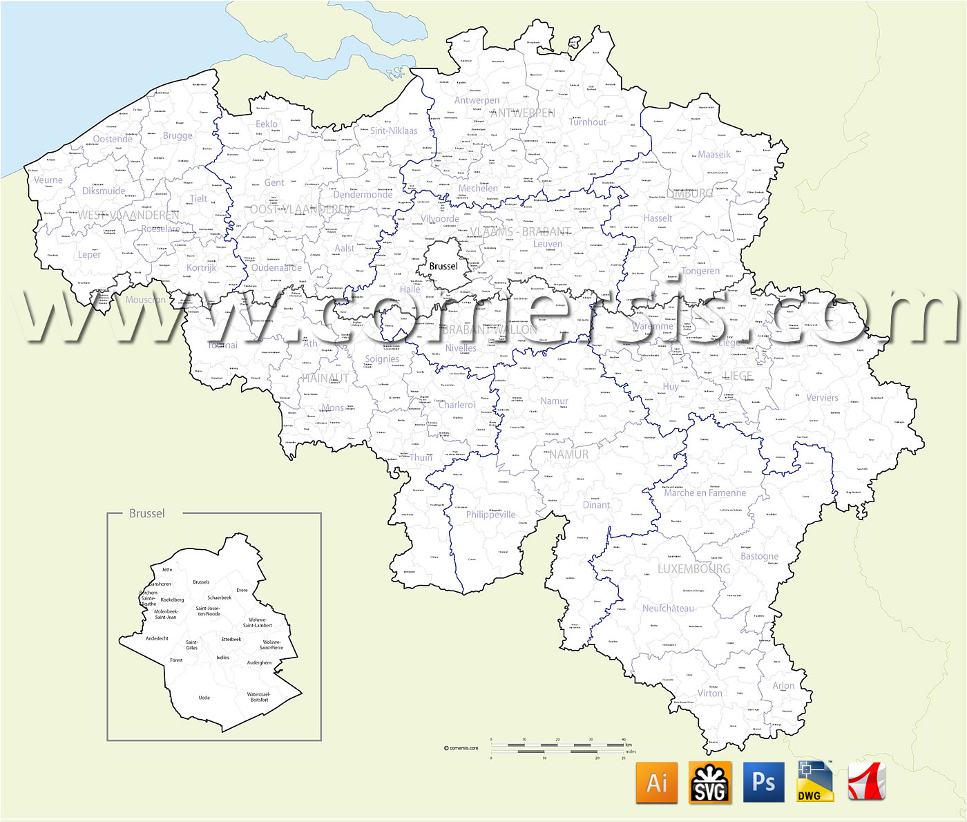
Belgian municipalities comprising the regions, districts and towns named, all in separate layers.
Original file 2000 x 1700 pixels.
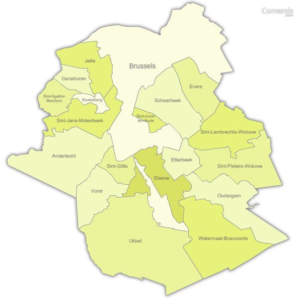
Free map of Brussels region municipalities including Illustrator, Flash and svg file.
Texts in Dutch
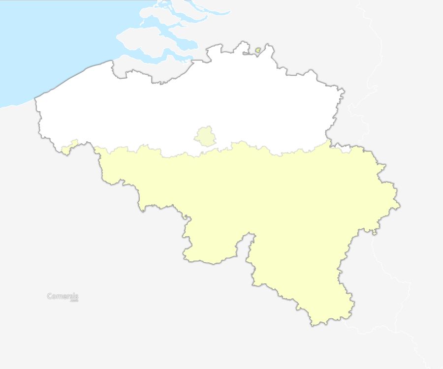
13 Province
Antwerpen, Brabant Wallon, Brussels, Flemish Region, Hainaut, Liège, Limburg, Luxembourg, Namur, Oost-Vlaanderen, Vlaams Brabant, Wallonia, West-Vlaanderen,