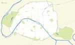
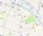
Free base map of the Greater Paris metropolis.
 click on the map to enlarge
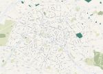
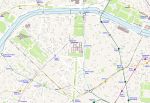
Free base map of the Greater Paris metropolis.
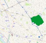
click on the map to enlargeEditable map of municipal and departmental boundaries of the Greater Paris Metropolis. Working document provided in Jpeg, Photoshop, Excel, Powerpoint, Illustrator, Pdf and Svg formats.
tags paris,metropole,map,free,base,city

 Download this map
 Editable Grand Paris metropolis
 Photoshop Grand Paris metropolis
 Jpg Grand Paris metropolis
 Excel Grand Paris metropolis
 Powerpoint Grand Paris metropolis
 Wmf Grand Paris metropolis
 Illustrator Grand Paris metropolis
 Pdf Grand Paris metropolis
 Svg Grand Paris metropolis