map

Ille-et-Vilaine counties map with names ( France ) for Word and Excel.


Ille-et-Vilaine counties map with names ( France ) for Word and Excel.

click on the map to enlarge

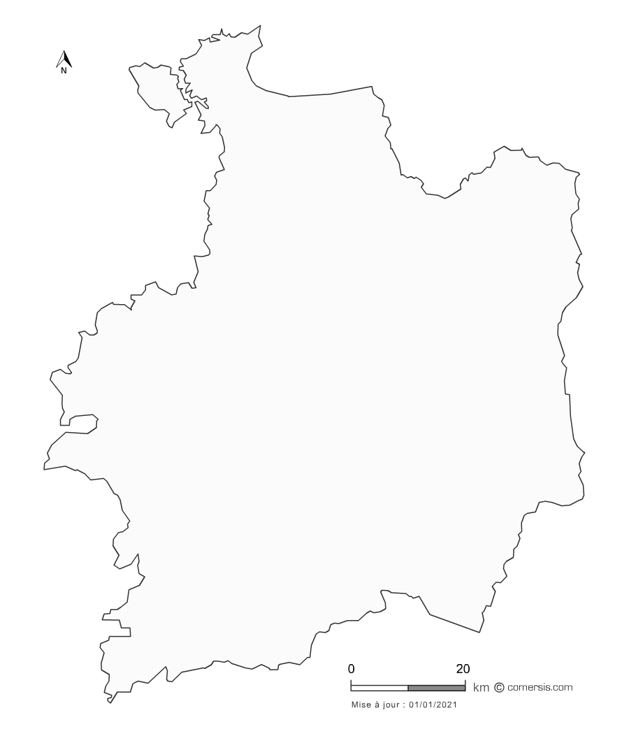
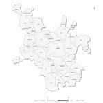
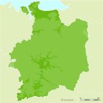
Editable counties map of Ille-et-Vilaine Office Excel and Word ready to use sheets. With full names.
Updated march 2014.

  • Resizable : Excel and Word map of Ille-et-Vilaine counties is drawn in vector wich allows a lossless image quality resize.
  • Splittable : By a simple MAJ+CLIC, you can select one or several areas (countries) of this map in order to create a detail map view (a kind of zoom) and resize it as you need.
  • Colorable : Each division of this map (countries) is independant. Borders, outlines, shapes, layout, texts can be modified.
  • Linkable : You can add hypertext links on text and areas.
  • Exprotable : Once your map edited, you can save it as a PDF document, a simple image or a clickable HTML web map page*.
  • By default, maps are pre-colored. It's just a mouse click to change !

    * Read our tutorials.


    tags nouveaux,cantons,Ille-et-Vilaine,cantonale,2014

    Files format *

    * Files contained in this download..


    See also


    35 Ille et Vilaine french department vector map

    35 Ille et Vilaine french department vector map

    Free vector flash map of Ille et Vilaine department. Eps, Swf and Svg map file. France department
    Rennes Metropole cities and roads

    Rennes Metropole cities and roads

    map of Rennes metropolis with editable vector formats Illustrator in layers, EPS in layers, Layered PDF and SVG.
    Emerald Coast vector map

    Emerald Coast vector map

    Coastline Map and road networks of the Emerald Coast in layers, from the Cap Frehel to Cancale.
    Rennes Metropole municipalities map

    Rennes Metropole municipalities map

    Customizable vector map of the 43 municipalities of the Metropole of Rennes.
    Ille-et-Vilaine municipalities vector map with names ( France ).

    Ille-et-Vilaine municipalities vector map with names ( France ).

    Editable cities map of Ille-et-Vilaine - France
    Illustrator, EPS, PDF and SVG ready to use files. Supplied with with a complete list and zipcodes of Ille-et-Vilaine municipalities (Excel).

    Ille et Vilaine vector relief map

    Ille et Vilaine vector relief map

    llustrator (.ai), Flash (open .swf) and SVG map file.
    administrative districts of Rennes

    administrative districts of Rennes

    Free customizable plan of the administrative districts of Rennes.

    Quotation

    Use our form for your free quote requests of interactive maps or vector maps:

    Request a quote map


    Who is comersis.com

    Comersis.com website
    29630 Plougasnou
    Tél.: (33).2 98 15 70 81

    New opening hours :
    Tuesday to Friday from 09h30 to 12h30
    Siret :387 676 828