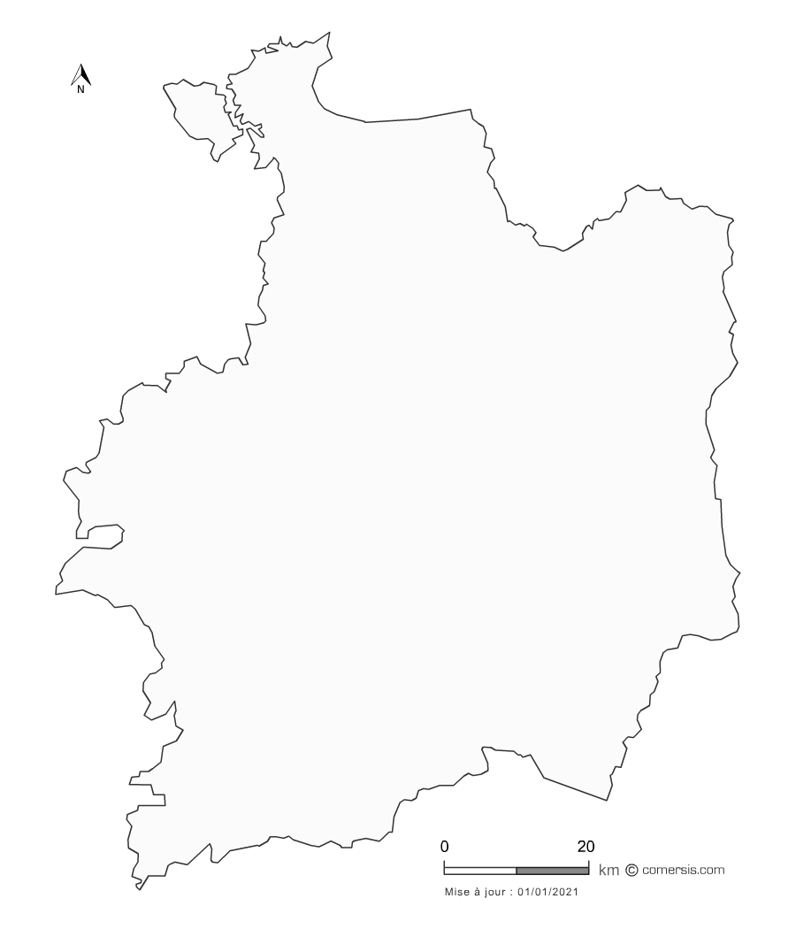
Customizable vector map of the 43 municipalities of the Metropole of Rennes.
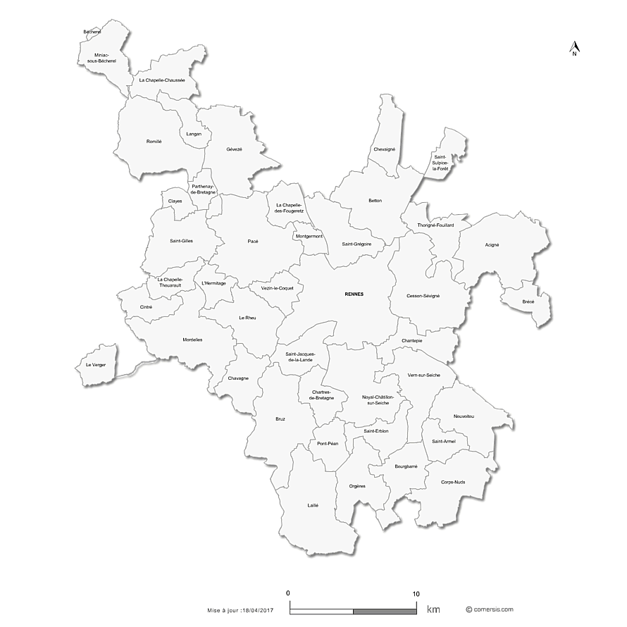 click on the map to enlarge
The files contained in this download
 Editable Rennes Metropole municipalities map
 Illustrator Rennes Metropole municipalities map
 Svg Rennes Metropole municipalities map
 Pdf Rennes Metropole municipalities map
 Wmf Rennes Metropole municipalities map
 Jpg Rennes Metropole municipalities map
 Photoshop Rennes Metropole municipalities map
 Excel Rennes Metropole municipalities map
 Word Rennes Metropole municipalities map
 Powerpoint Rennes Metropole municipalities map