Illustrator, EPS base map of French Côte d'Amour with layers roads, cities, hydrography.
 click on the map to enlarge
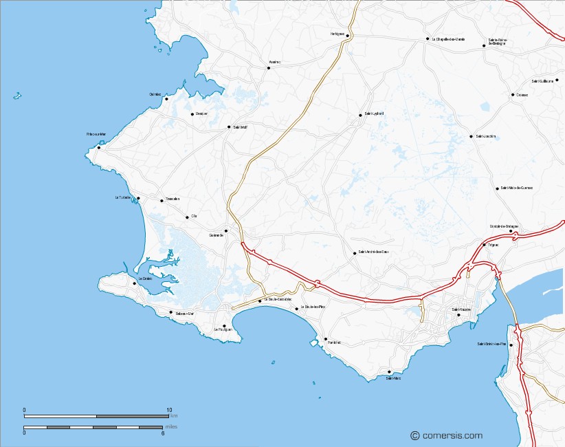
Illustrator, EPS base map of French Côte d'Amour with layers roads, cities, hydrography.
click on the map to enlargeThis base map represents the Loire-Atlantique coastline located between Mesquer and the estuary of the Loire after Saint Nazaire.
The seaside municipalities within its coast are Saint-Nazaire, Pornichet, La Baule, Le Pouliguen, Le Croisic, Batz-sur-Mer, Guérande, La Turballe, Piriac-sur-Mer, Quimiac and Mesquer .
tags Cote,littoral,amour,la Baule,Pornichet,map,france,vector,Illustrator
 Editable Cote d'Amour coast map with roads and cities
 Illustrator Cote d'Amour coast map with roads and cities
 Eps Cote d'Amour coast map with roads and cities
 Svg Cote d'Amour coast map with roads and cities
 Jpg Cote d'Amour coast map with roads and cities