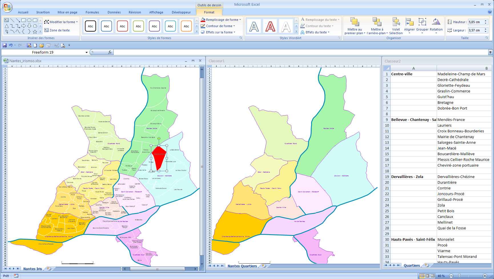
Customizable map of Nantes districts and sub-districts. IRIS sub-municipal zoning.
 click on the map to enlarge
Customizable map of Nantes districts and sub-districts. IRIS sub-municipal zoning.
click on the map to enlargeAbout IRIS zoning: https://www.insee.fr/fr/metadonnees/definition/c1523
tags Nantes,quartiers,carte,Office
 Editable Nantes districts and IRIS zoning
 Excel Nantes districts and IRIS zoning
 Powerpoint Nantes districts and IRIS zoning
 Word Nantes districts and IRIS zoning