Customizable base map of the administrative districts of the city of Angers, Maine-et-Loire, France.
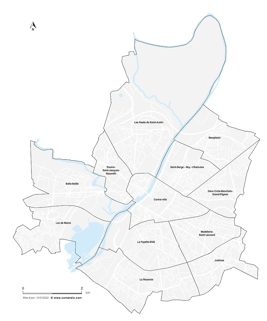 click on the map to enlarge
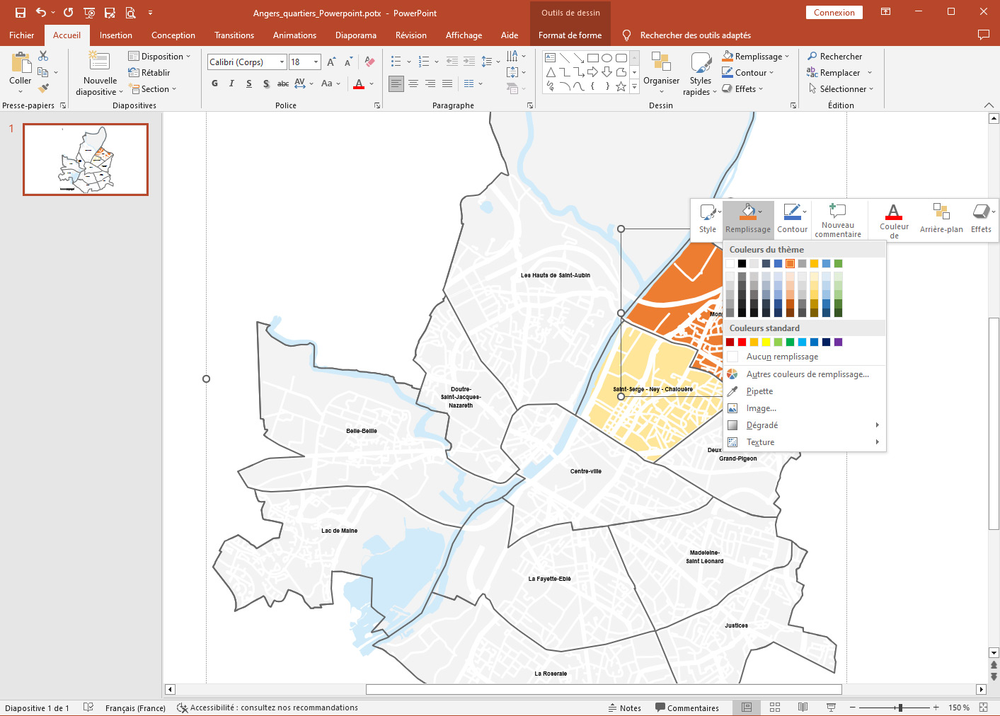
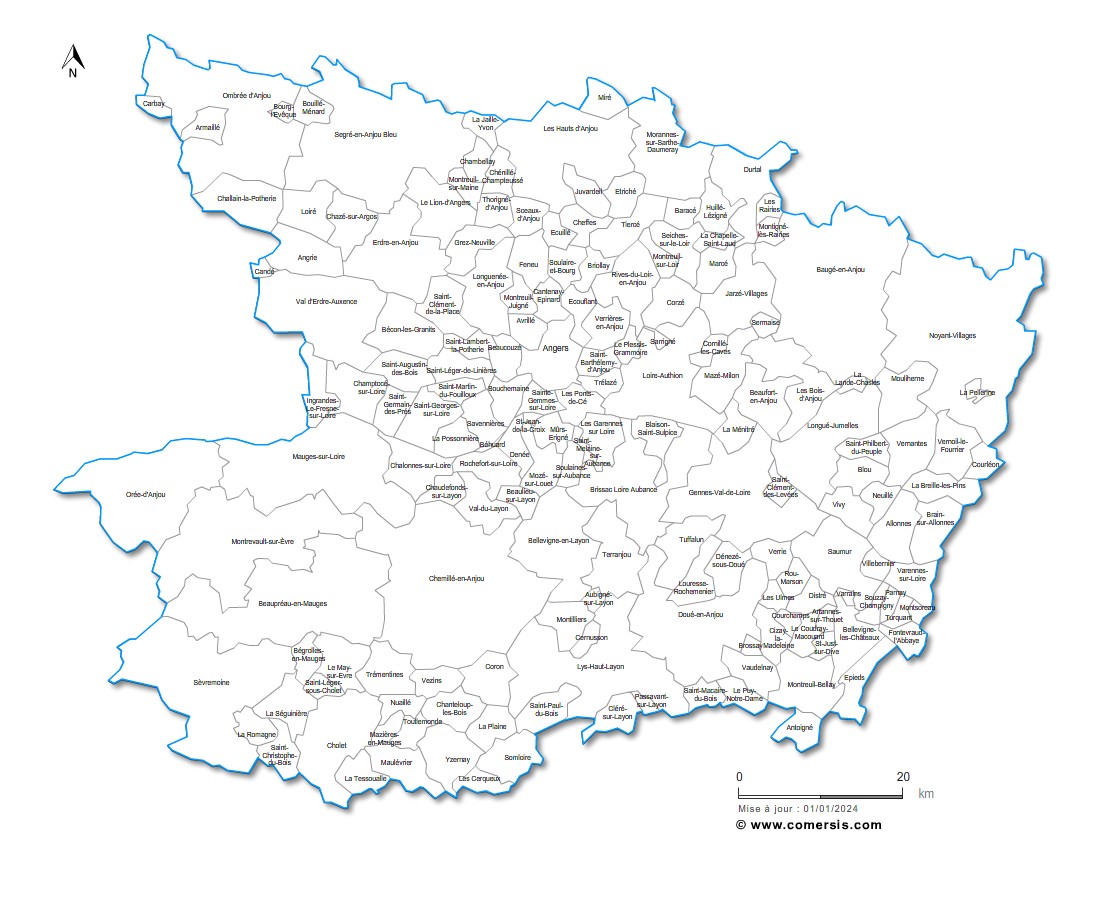
Customizable base map of the administrative districts of the city of Angers, Maine-et-Loire, France.
click on the map to enlarge tags Angers,map,districts,roads
 Editable Angers neighborhoods map
 Illustrator Angers neighborhoods map
 Svg Angers neighborhoods map
 Pdf Angers neighborhoods map
 Powerpoint Angers neighborhoods map
 Jpg Angers neighborhoods map