Toggle navigation
map.comersis.com
New maps
Guide
Ressources
Labo
Ressources
Faq
Site map
Conditions
Licences
Espace client
Write us
maps
Maps of Maine-et-Loire
Select areas in Maine-et-Loire
>
Europe
>
France
>
Pays de la Loire
>
Maine-et-Loire
4 maps of Maine-et-Loire
R117 other maps...
Loire-Atlantique
Mayenne
Sarthe
Vendée
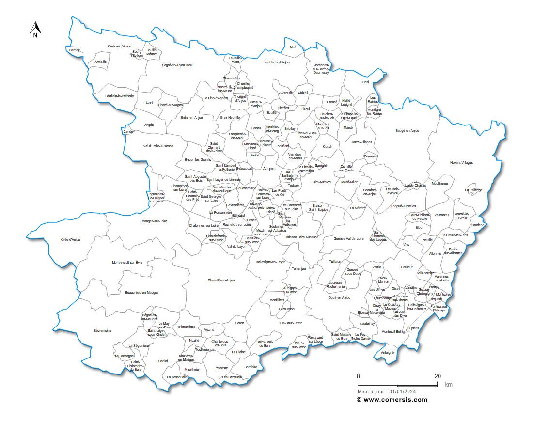
Maine et Loire ( 49 )...
More info
free
Maine-et-Loire...
More info
€ 30.00
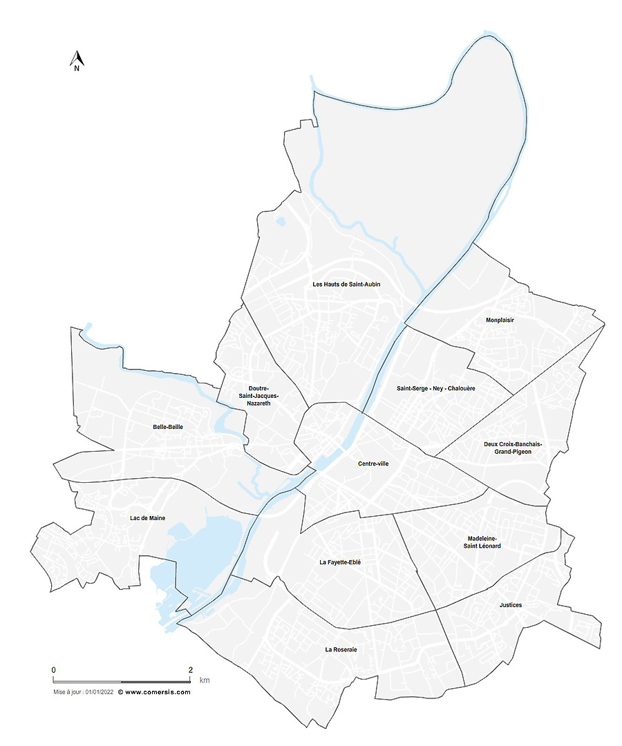
Angers neighborhoods map
More info
€ 8.00
Maine-et-Loire counties map...
More info
€ 24.90
See also:
Loire-Atlantique
Mayenne
Sarthe
Vendée
By continuing your visit to this site, you accept the use of cookies in order to memorize your list of choices, your shopping cart and guarantee you the best possible navigation.
I accept
Learn more


 Loire-Atlantique