Configurable interactive map of major countries of the world, built in SVG and XML / php.
 click on the map to enlarge
Configurable interactive map of major countries of the world, built in SVG and XML / php.
click on the map to enlarge Mobile Phones and Tablets Compatible
 Example
tags World,svg,responsive,interactive,xml,countries,map
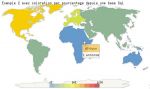
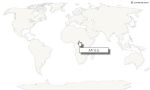
 Configurable Responsive World interactive map for web
 Svg Responsive World interactive map for web
 Xml Responsive World interactive map for web
 Php Responsive World interactive map for web