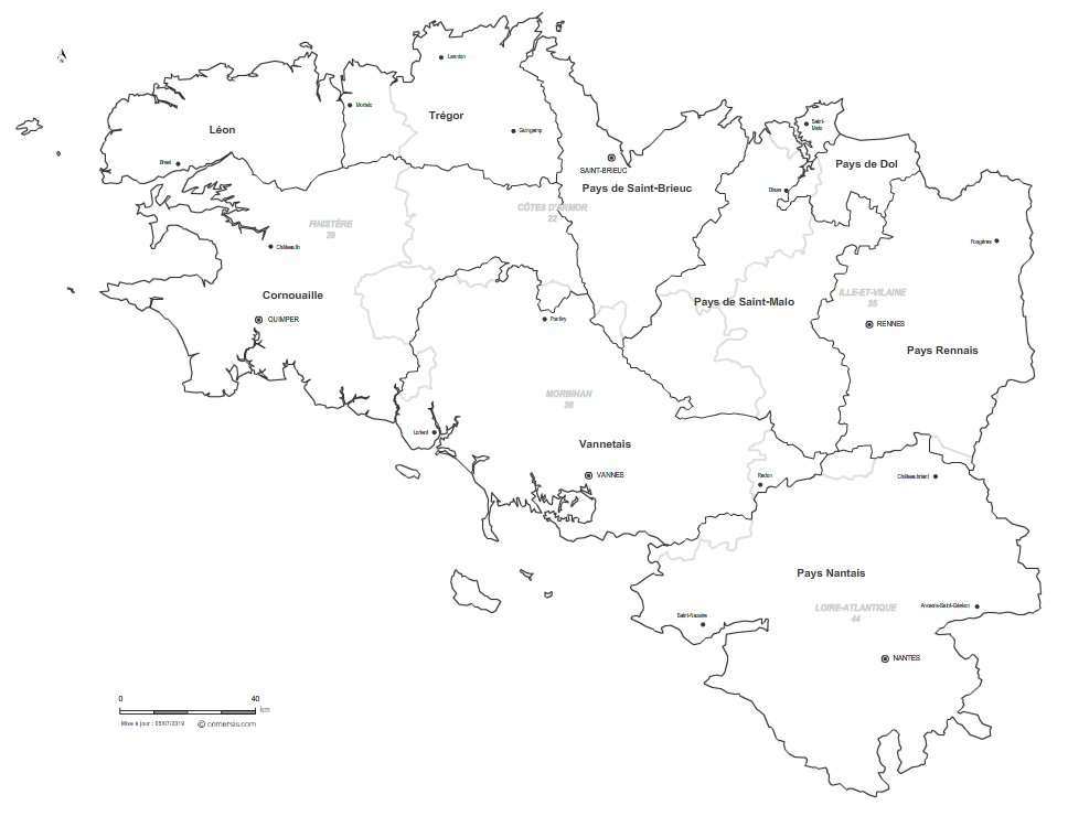
Customizable vector map of the historical countries of Brittany (France).
 click on the map to enlarge
Customizable vector map of the historical countries of Brittany (France).
click on the map to enlargeModifiable base map of the 9 Historic Breton Countries:
This map comes in 5 different file formats, Illustrator in layers for infographics, SVG, PDF for large format printing, Powerpoint for office and high resolution Jpeg.
tags Bretagne,map,pays,tradition,vector
 Illustrator Brittany traditionnal countries.
 Svg Brittany traditionnal countries.
 Pdf Brittany traditionnal countries.
 Jpg Brittany traditionnal countries.
 Powerpoint Brittany traditionnal countries.