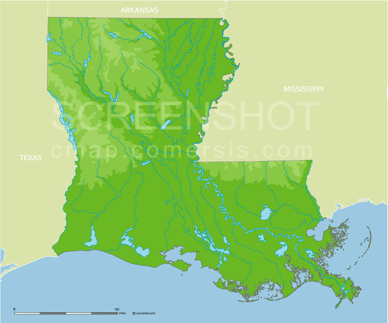
Elevation vector map of Louisiana state with lakes and rivers, borders states. Illustrator, Swf and SVG format.
 click on the map to enlarge
Elevation vector map of Louisiana state with lakes and rivers, borders states. Illustrator, Swf and SVG format.
click on the map to enlargetags
 Illustrator Louisiana state elevation map
 Swf Louisiana state elevation map
 Svg Louisiana state elevation map