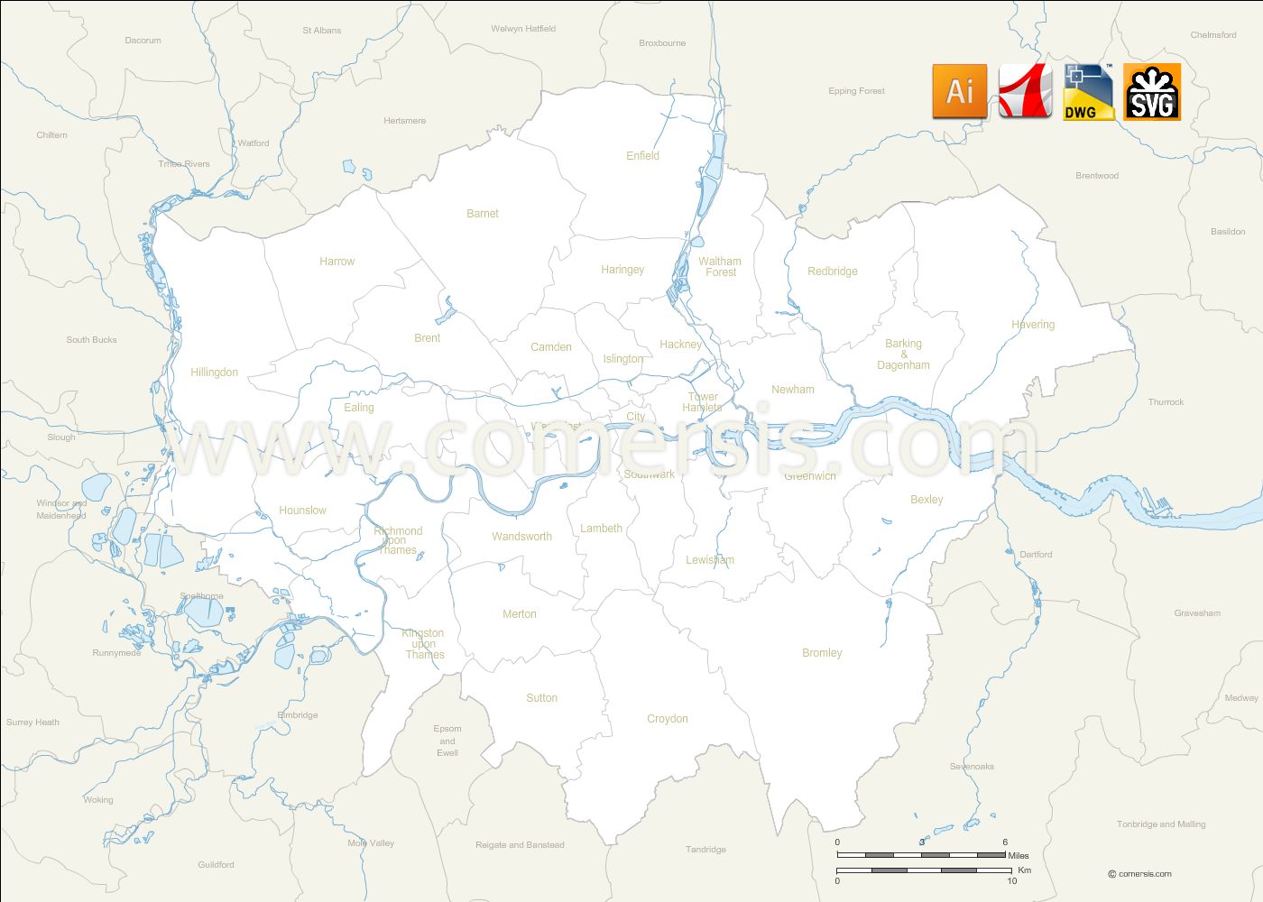
Editable map of Greater London borough with names and neighboring districts. Files in Illustrator Ai, Svg, Autocad DWG and Acrobat Pdf.
 click on the map to enlarge
Editable map of Greater London borough with names and neighboring districts. Files in Illustrator Ai, Svg, Autocad DWG and Acrobat Pdf.
click on the map to enlargetags London,districts,map
 Illustrator Greater London vector map with borough boundaries and names
 Svg Greater London vector map with borough boundaries and names
 Dwg Greater London vector map with borough boundaries and names
 Pdf Greater London vector map with borough boundaries and names